Where Is Cabo San Lucas?
Oh, you mean other than on the edge of paradise?
Cabo San Lucas is located in the Mexican state of Baja California Sur (BCS). Those who frequent the area more commonly refer to this area as “The Baja.” Baja California is made up of two parts: Baja California and Baja California Sur (South). Back in the 1800’s, all of Baja California and the American state, California, were owned by Mexico. This all changed during the Mexican/American War, which began after Mexico refused to sell several different states, including California, to the United States of America. In 1848, when the war was over, Mexico and the USA came to an agreement that Mexico would take Baja California and the USA would take Alta California, commonly known today as “California.”
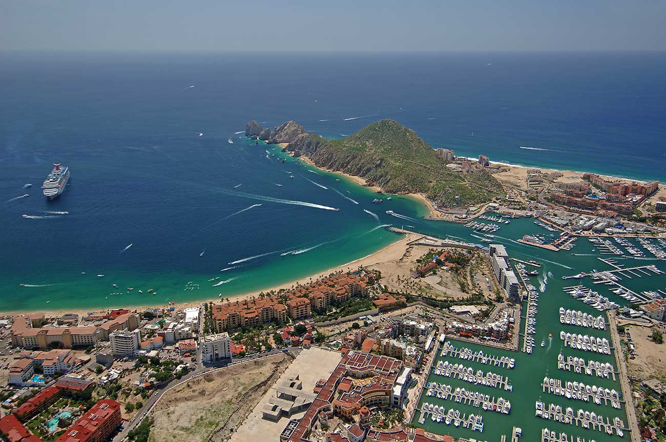
Los Cabos is located at the southern-most point of the state of Baja California Sur, directly in the middle of the Sea of Cortez and the Pacific Ocean. The famous rock formation at Lands End, The Arch or “El Arco”, is a natural stone arch that can only be seen by taking a water taxi to the secluded Lover’s and Divorce Beach. The Arch is the last point of land on the Mexican peninsula and marks the point of intersection between the two bodies of water. Many people believe the mixing of the cold Pacific water and the warm Sea of Cortez water is why Cabo is one of the best sportfishing destinations in the world.
When most people think of “Cabo,” they are thinking about Cabo San Lucas. The place where spring breakers go to find the best party in Mexico. However, Cabo is much more than just a party area. “Cabo” is technically called Los Cabos and is comprised of two major cities: Cabo San Lucas and San Jose del Cabo. Cabo San Lucas is located directly on the southern point of BCS. This point for geography enthusiasts, is 22°52’33.0″N 109°53’40.1″W (or 22.875839, -109.894459). San Jose del Cabo is located about 30-minutes east of Cabo San Lucas along the coastline. The area in between these two cities is called the Tourist Corridor and features many of Los Cabo’s favorite beaches and resorts.
To access Cabo via car, there is only one way in and one way out; through the Baja. From Mexico border in Tijuana, it is 1,000 miles and takes about 24-hours to drive to Cabo San Lucas. While that drive may sound like a long time, those who make the trek end up loving the adventure and wanting to explore more of BCS. Passing through quaint and historic towns such as La Paz, Loreto, Guerrero Negro, and more gives you an experience of what this incredible area is like.
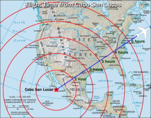
The quickest, easiest, and most cost-effective way to get to Cabo is via plane. If you are flying commercial, you will be arriving at the Los Cabos International Airport (SJD). This is located about 40 minutes northeast of Cabo San Lucas. Cabo serves direct flights from many different areas including Los Angeles, San Diego, Dallas, Houston, Phoenix, Denver, and more. Flight time to Los Cabos is about 2-hours from LA, SD, Phoenix, and Mexico City. It’s 3-hours from San Francisco, 4-hours from Atlanta and Seattle, and 5-hours from New York and southern Canada.